Subscribe to Our Social Media For Prompt Post
LiDAR, standing for Light Detection and Ranging, represents a pinnacle in remote sensing technology. It operates by emitting light beams, typically as pulsed lasers, and measures the time taken for these beams to reflect back from objects. Propagating at light speed, approximately 3×10⁸ meters per second, LiDAR precisely calculates the distance to an object using the formula: Distance = Speed × Time. This technological marvel has found diverse applications globally, revolutionizing fields from autonomous vehicles to environmental monitoring, and from urban planning to archaeological discoveries. This comprehensive exploration delves into 10 key applications of LiDAR, illustrating its profound impact across various sectors.
1. Automotive LiDAR
LiDAR is essential in the realm of autonomous driving. It generates intricate environmental maps by emitting and capturing laser pulses. This functionality allows self-driving vehicles to identify other vehicles, pedestrians, obstacles, and road signs in real time. The 3D images produced by LiDAR enable these vehicles to navigate complex environments, ensuring swift and safe decision-making. In urban environments, for example, LiDAR is crucial for detecting stationary vehicles, anticipating pedestrian movements, and maintaining accurate perception in challenging weather conditions.
→Read more about the LiDAR Applications in Automotive vehicles.

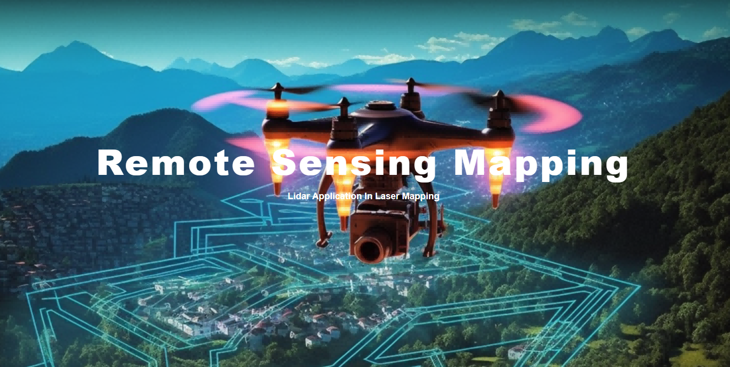
2. Remote Sensing Mapping
LiDAR significantly enhances the accuracy and efficiency of terrain mapping. Utilized from aircraft or satellites, it rapidly collects topographical data over large areas. This data is vital for urban planning, flood risk analysis, and transportation infrastructure design. LiDAR assists engineers in identifying terrain challenges when planning new highways, leading to routes that minimize environmental impact and maximize construction efficiency. Additionally, LiDAR can reveal hidden topographical features beneath vegetation, proving invaluable in archaeological and geological explorations.
→ Read more about the LiDAR Applications in Remote Sensing Mapping
3. Forestry and Agriculture:
In forestry, LiDAR is used to measure tree height, density, and landform characteristics, which are essential for forest management and conservation. LiDAR data analysis helps experts estimate forest biomass, monitor forest health, and assess fire risks. In agriculture, LiDAR supports farmers in monitoring crop growth and soil moisture, optimizing irrigation practices, and enhancing crop yields.

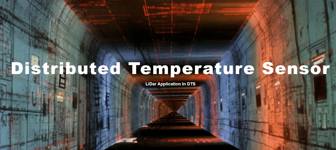
4. Distributed Temperature Sensing:
LiDAR is particularly important in distributed temperature sensing, a crucial aspect in large industrial setups or energy transmission lines. The DTS LiDAR remotely monitors temperature distributions, identifying potential hotspots to prevent faults or fires, thereby ensuring industrial safety and improving energy efficiency.
5. Environmental Research and Protection:
LiDAR plays a crucial role in environmental research and conservation efforts. It is used to monitor and analyze phenomena such as sea-level rise, glacier melting, and deforestation. Researchers utilize LiDAR data to track glacier retreat rates and evaluate the impacts of climate change on ecosystems. LiDAR also monitors air quality in urban and agricultural settings, contributing to the development of effective environmental policies.
6. Urban Planning and Management:
LiDAR is a powerful tool in urban planning and management. The collection of high-resolution 3D data allows planners to better understand urban spatial structures, aiding in the development of new residential areas, commercial centers, and public facilities. LiDAR data is instrumental in optimizing public transportation routes, evaluating the impact of new constructions on cityscapes, and assessing infrastructure damage following disasters.
7. Archaeology:
LiDAR technology has transformed the field of archaeology, opening new possibilities for discovering and studying ancient civilizations. Its ability to penetrate dense vegetation has led to the discovery of hidden artifacts and structures. For example, in the tropical rainforests of Central America, LiDAR has revealed thousands of previously unknown Maya sites, greatly enhancing our knowledge of these ancient societies.
8. Disaster Management and Emergency Response:
LiDAR is invaluable in disaster management and emergency response scenarios. Following events such as floods or earthquakes, it quickly evaluates damage, aiding in rescue and recovery efforts. LiDAR also monitors the impact on infrastructure, supporting repair and reconstruction initiatives.
→Related Article:Laser Application in Safe Guard, detection & surveillance
9. Aviation and Space Exploration:
In aviation, LiDAR is employed for atmospheric research, measuring parameters like cloud thickness, air pollutants, and wind speeds. In space exploration, it equips probes and satellites for detailed assessments of planetary topography. For instance, Mars exploration missions use LiDAR for comprehensive mapping and geological analysis of the Martian surface.
10. Military and Defense:
LiDAR is critical in military and defense applications for reconnaissance, target identification, and terrain analysis. It aids in navigation across complex battlefields, threat detection, and tactical planning. Drones equipped with LiDAR conduct precise reconnaissance missions, providing essential intelligence.
Lumispot Tech specializes in LiDAR Laser Light Sources, our products contain the 1550nm Pulsed Fiber Laser, 1535nm Automotive LiDAR laser Source, a 1064nm Pulsed Fiber Laser for OTDR and TOF ranging, etc., click here to see our LiDAR laser source product list.
Reference
Bilik, I. (2023). Comparative Analysis of Radar and Lidar Technologies for Automotive Applications. IEEE Transactions on Intelligent Transportation Systems.
Gargoum, S., & El-Basyouny, K. (2017). Automated extraction of road features using LiDAR data: A review of LiDAR applications in transportation. IEEE International Conference on Transportation Information and Safety.
Gargoum, S., & El Basyouny, K. (2019). A literature synthesis of LiDAR applications in transportation: feature extraction and geometric assessments of highways. Journal of Transportation Engineering, Part A: Systems.
Post time: Jan-10-2024


